Change-in-Use Project Maps
This section illustrates the potential reach and impact of Better Trails | Greater Access change-in-use (CIU) submissions as part of Trails 2035. Even if all three phases (or projects) are reviewed, approved and implemented in full by 2035, the access ratio of off-road cyclists to singletrack trails at Mount Diablo State Park would increase to approximately 47%, up from 18% currently.
That relative gap to the access ratios of Hikers and Trail Runners at 100% and Equestrians at 99.5% would ensure that there are still plenty of singletrack trail miles not open to off-road cyclists.
Phase I
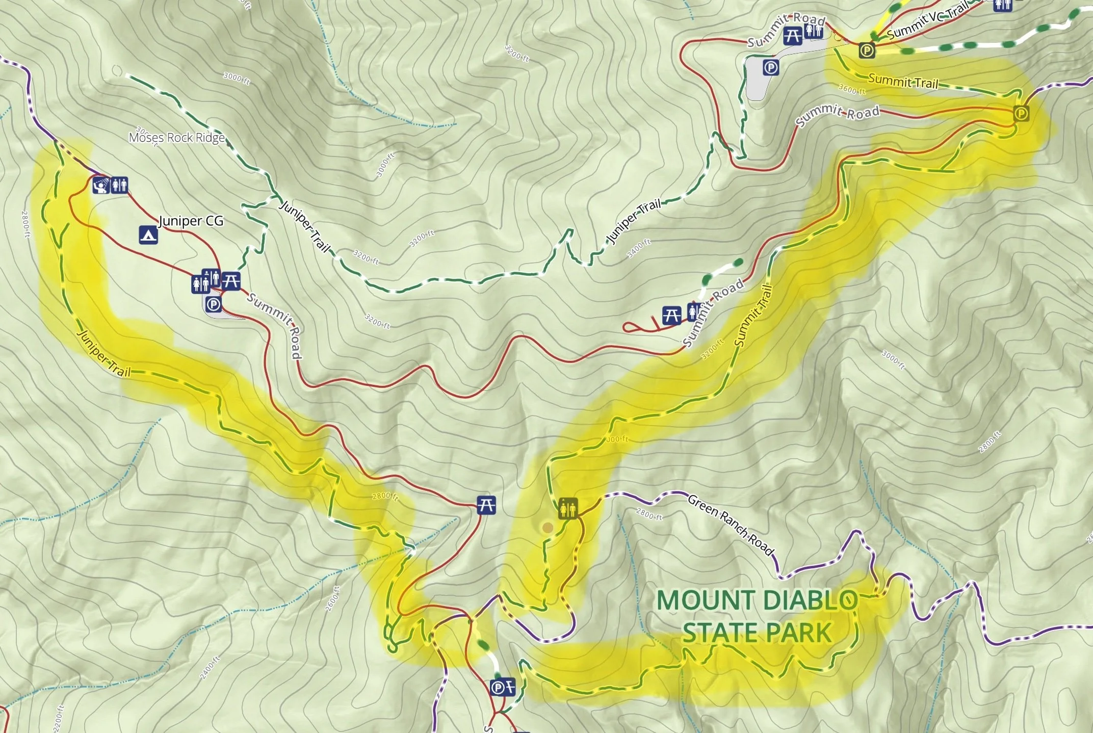
Trails: Lower Juniper, Upper Summit and Oak Knoll
Map source: Mount Diablo State Park ARCGIS
Phase II
Trails: Little Yosemite, Camel Rock, Secret, Bruce Lee Spring, Donner, Hetherrington, Wasserman, Coulter Pine, Lower Back Creek/Tick Wood, and Olympia
Maps source: Mount Diablo State Park ARCGIS
Little Yosemite and Camel Rock Trails (Lower Mountain)
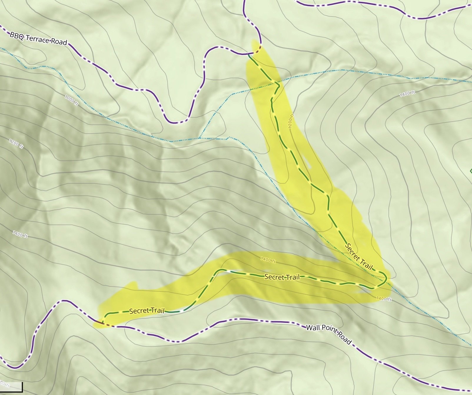
Secret Trail (Lower Mountain)

Olympia Trail (Clayton Side)
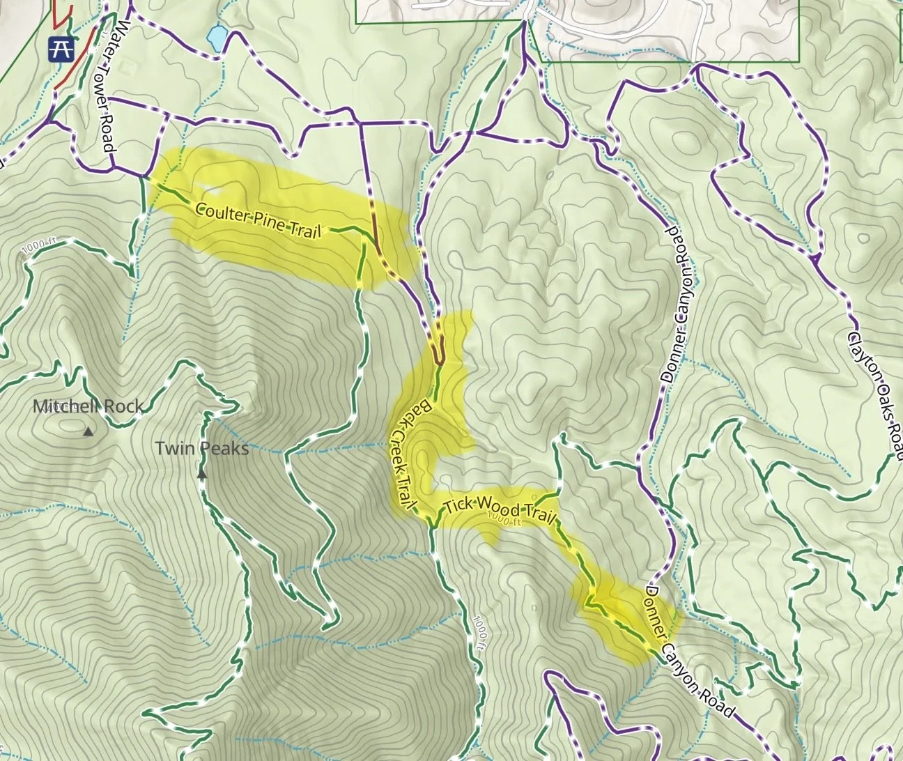
Coulter Pine and Lower Back Creek/Tick Wood Trails (Clayton Side)
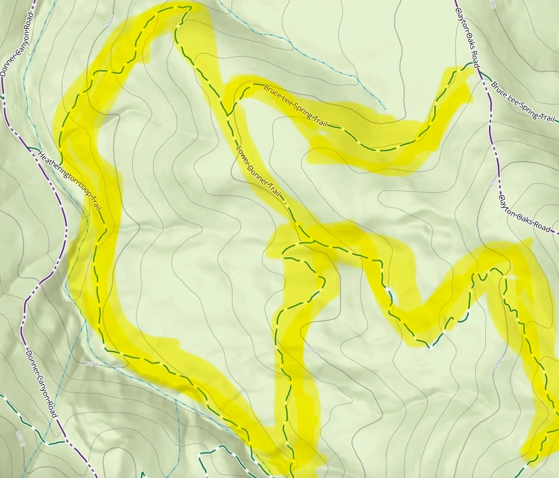
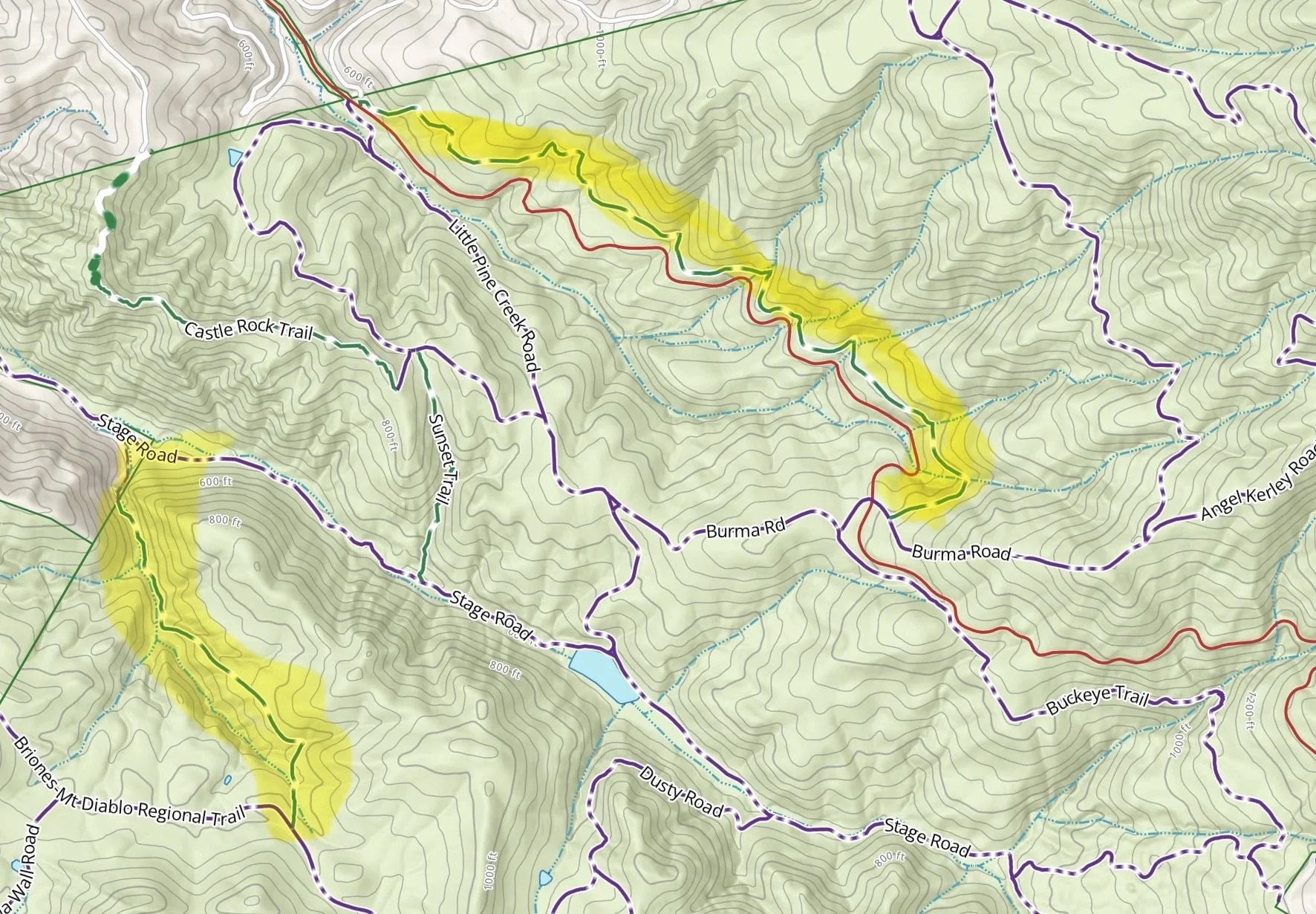
Bruce Lee Spring, Donner, Hetherrington, and Wasserman Trails (Clayton Side)
Phase III
Trails: Bob’s Pond, Tassajara Creek, Jeremiah, Walnut, Madrone (Trail through Time), and Devil’s Slide
Maps source: Mount Diablo State Park ARCGIS
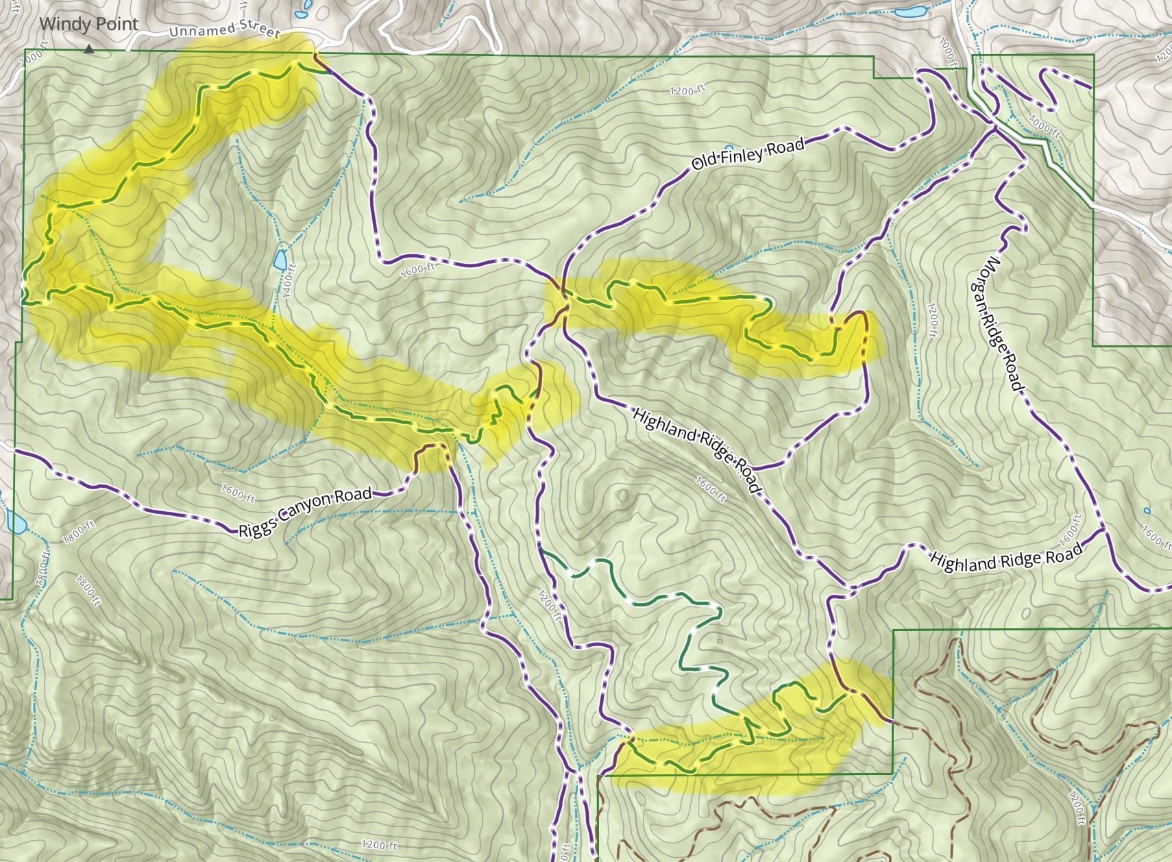
Bob’s Pond, Tassajara Creek, Jeremiah and Walnut Trails
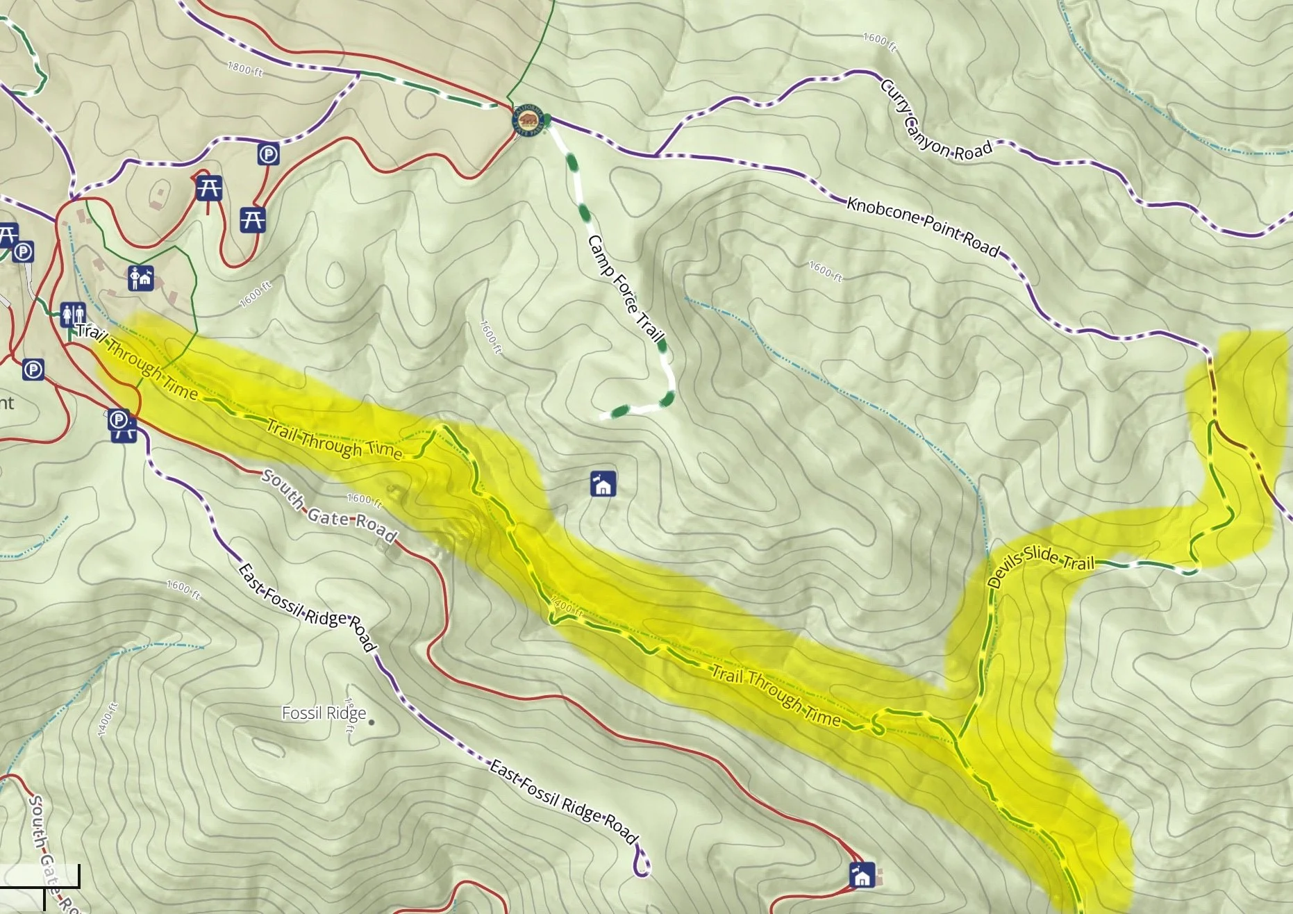
Madrone (Trail through Time) and Devil’s Slide Trails