Better Trails | Greater Access Goals
Goal #1 - Improve Access Ratio for Off-Road Cyclists to ~50%
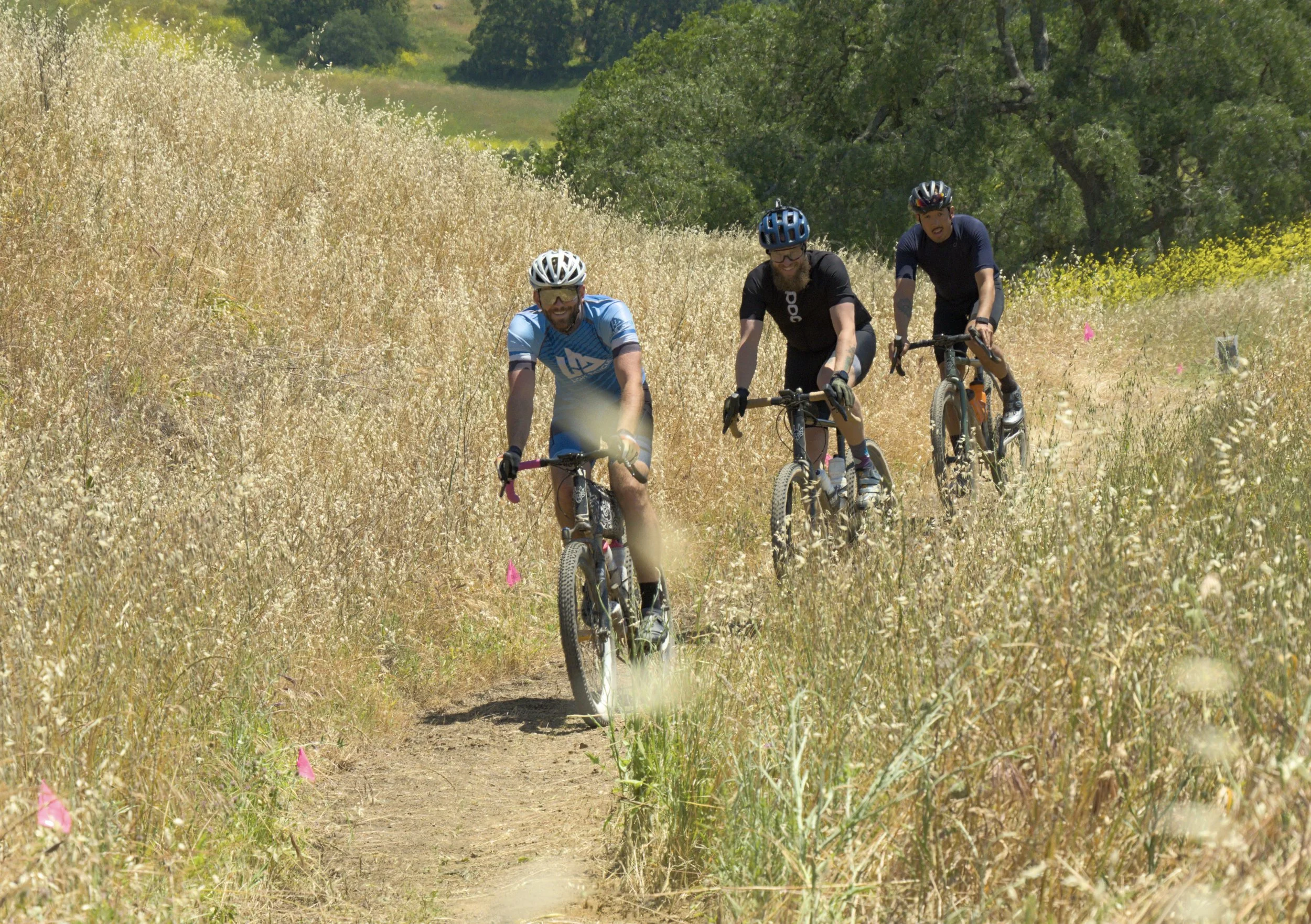
Issue: Off-road cyclists have grown into one of the largest trail user groups, with local youth team participation growing more than 10% each year over the past decade. However, only 9.5 miles or 18% of singletrack trails at Mount Diablo State Park are open to bikes, which can impact both safety conditions and circulation, connector and loop options in the trail network.
Requiring off-road cyclists to be disproportionately restricted to steeper, rugged fire roads is not welcoming, as on average the elevation grade percentage of oft-damaged fire roads at Mount Diablo State Park are approximately two times steeper than single track trail elevation grades, as illustrated in the below comparison sheet (see table).
That elevation grade penalty can present accessibility and safety risks, especially for park visitors with time or physical constraints, including tomorrow’s leaders – the Kids.

Trails 2035 Solution
Secure 15 additional miles of singletrack trails for multi-use bike friendly access through the change-in-use (CIU) process.
This goal aims to increase the access ratio of off-road cyclists closer to 50%, which still would remain much lower than the access ratios for hiking/running (100%) and equestrian trail user groups (99.5%).
Action Plan
Propose and secure CIU access gains through three submissions or phases, as illustrated below.
Phase I already was submitted in August 2024 and focused on the 2016 Road and Trail Management Plan (RTMP) policy recommendations to get more trail users off of the Upper Mountain’s roadway to improve safety conditions and circulation, connector and loop options.
With planned Phase II and Phase III submissions, MDTA identifies CIU opportunities to extend the RTMP’s goals of improved safety and circulation, connector, and loop options to all corridors of Mount Diablo State Park.
Phase I - Upper Mountain
August 2024 - Actual Submission by MDTA
Trails: Lower Juniper, Oak Knoll Upper Summit, and Buckeye Switchback Connector to North Gate Road
Potential CIU access gains: approximately 3.2 miles
Phase II - Lower Mountain and Clayton Side
Winter 2026 - Planned Submission by MDTA
Lower Mountain Trails: Secret, Camel Rock, and Little Yosemite
Potential CIU access gains: approximately 3.0 miles
Clayton Side Trails: Coulter Pine, Lower Back Creek/Tick Wood, Bruce Lee Spring, Donner, Hetherrington, Wasserman and Olympia
Potential CIU access gains: approximately 4.4 miles
Phase III - Southern Corridor
Summer 2026 - Planned Submission by MDTA
Trails: Bob's Pond + Tassajara Creek, Madrone Canyon Trail (uphill only), Jeremiah Creek, Walnut, and Devil's Slide
Potential CIU access gains: approximately 4.9 miles
Goal #2 - Increase Number of ADA-Compliant Trails
Issue
Mount Diablo State Park lacks ADA-compliant trails. Currently, only a small portion of the Mary Bowerman Trail at the summit meets accessibility standards. Out of 52.5 miles of singletrack trails at Mount Diablo, less than 1 mile is ADA compliant.
Trails 2035 Solution
Raise funds to pay for environmental compliance studies, route design, and new construction services and materials to build two ADA-compliant trails at Mount Diablo State Park.
Action Plan
One proposed trail would be on the upper mountain (Muir Day Use Area) and the other one on the middle mountain (Camp Force Trail).
Both ADA-compliant trails are policy recommendations in the 2016 Road and Trail Management (RTMP). It is time to implement these long overdue accessibility improvements.
Refer to Mount Diablo State Park ARCGIS-based maps in the next section for orange highlights of the potential trail locations.
Proposed ADA-Compliant Trail Locations (Highlighted in Orange)
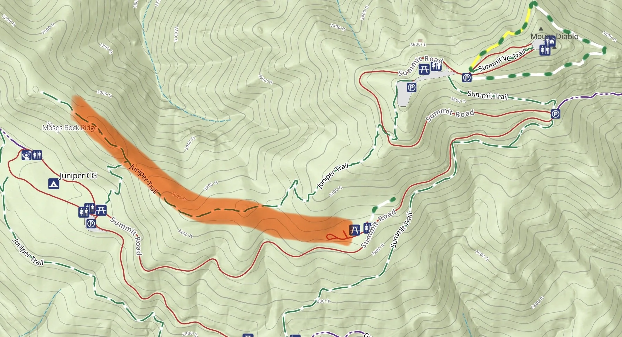
Muir Day Use Area
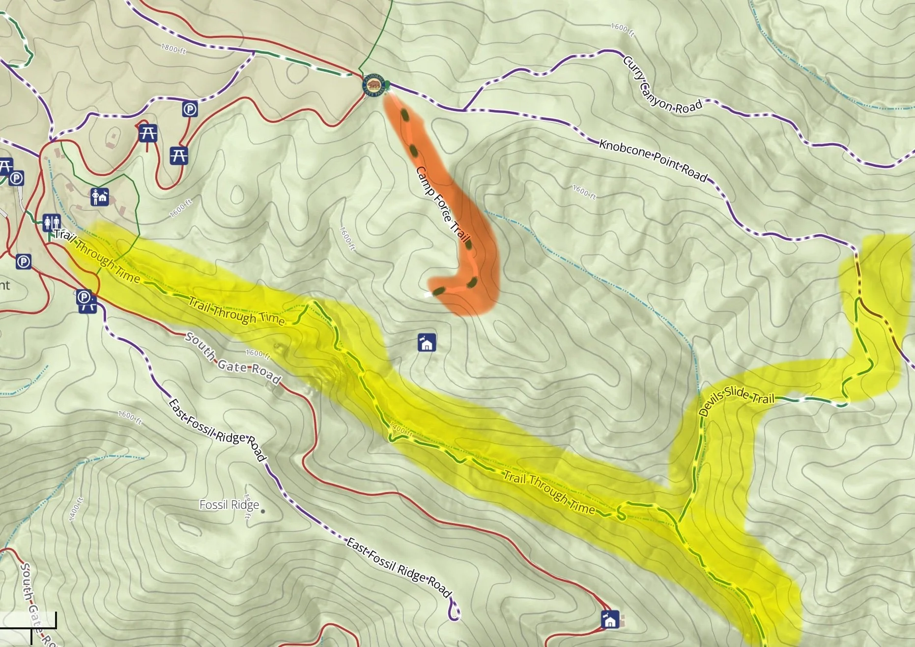
Camp Force Trail
Goal #3 - Fund Rare Plant Surveys in Sensitive Areas to Sustain Regular Trail Maintenance
Issue
Mount Diablo State Park is home to many rare plants. While trail maintenance and recreational interests are important, sound conservation-based protective measures of the park’s ecological and cultural resources are as well.
There are a host of trails (e.g., Bald Ridge, Eagle Peak, North Peak) requiring rare plant surveys before at-standard trail maintenance (as prescribed by the California Department of Parks and Recreation Trails Handbook) can occur as part of the Dig Day trail stewardship program.
Since October 2023 inception, more than 20 Dig Days have serviced 11 miles of trail tread with the help of nearly 1,000 community volunteers! To continue that momentum and service other areas of the state park, rare plant surveys will have to occur first.
Trails 2035 Solution
Raise funds to pay for rare plant surveys to ensure that trails can be maintained by Dig Day events without damaging rare flora and fauna, especially on trails above 2,500 feet elevation.
Action Plan
The goal is to raise funds now. That way, the important rare plant surveys can commence in Spring 2026, ensuring trail maintenance projects can be held on Bald Ridge, Eagle Peak and North Peak trails sometime in 2027 or 2028.